Geography Facts Every Kid Should Know
/granite-web-prod/16/56/16561f7163f848fe9bb7fbcc389a15cd.jpeg)
The world is a big place. It's so big that even though humans have been around for millions of years, we still haven't explored it all. Still, we're doing the best we can by studying geography.
Geography for kids can be a little confusing, so we broke it down into bite-sized basics that every kid should know. After learning these fundamentals of geography, kids will have a few fun facts to impress grandma and grandpa.
Geography Is the Study of Earth
/granite-web-prod/d1/db/d1db859e0f544608aa03791e1738c26e.jpeg)
It's easy to get "geography" mixed up with similar-sounding words like "geometry," the study of shapes, or "geology," the study of rocks and minerals.
The first important piece of geography trivia to know is that geography is actually the study of our planet, Earth. The word comes from Greek roots meaning "Earth" and "to draw."
Basically, studying geography means learning about the Earth's features and inhabitants, and recording what you discover along the way.
An Expert in Geography Is Called a Geographer
/granite-web-prod/0b/08/0b0883302be8449e9dabbb0b8e81ca94.jpeg)
You might have heard of a biologist, someone who studies living things, or an astronomer, someone who studies the stars. Similarly, an expert in geography is called a geographer.
Geographers try to understand many aspects of our planet, like how it formed and how it has changed over time. Earth formed 4.54 billion years ago, so figuring out how it came to look how it does today is a big job.
Geography now is different than ever before, so geographers are always learning something new.
There Are Two Types of Geography
/granite-web-prod/e7/98/e79808fe534f4bd29c585c0c9da7503f.jpeg)
As you can imagine, there's a ton to learn about a planet as big as Earth. When explaining geography for kids, it's important to break it into more digestible pieces. The same goes for the pros. A single geographer can't learn everything at once, so the study of geography is divided into two categories.
Physical geography revolves around nature. Physical geographers study things like mountains, oceans, valleys and other geographical features that formed throughout the millennia.
Human geography is a little different. Human geography examines how many people live in each country, their culture and how they've changed over time. Remember, people are the ones who made countries, so countries change shape and size, too.
Geography Changes Over Time
/granite-web-prod/fe/98/fe982def497340aaad7cbb278c07a337.png)
Speaking of change, geography never stays the same. You already know that Earth is comprised of both land and oceans, but the shape of the land we live on is very different than it was a few million years ago.
One fun geography trivia tidbit is that about 335 million years ago, there was just a single, giant landform on Earth that scientists named Pangea. It lasted for about 2 million years before slowly breaking into the continents we have today.
It started when a rift, or separation, formed in the middle of the continent, gradually dividing it into two pieces with a new ocean in the middle. It's likely that the continents will come together to form a new supercontinent again one day, but not for another few hundred million years.
There Are Currently Seven Continents
/granite-web-prod/c9/80/c98027c2de984d028f1c82eaa95c8fee.jpeg)
As you can see on the geography world map, after Pangea broke up, it formed seven large pieces that spread across the globe called continents. People named these continents North America, South America, Africa, Asia, Europe, Australia and Antarctica.
Every continent is unique. The continents around the middle of the earth are much warmer than the continents toward the North and South Poles. This area, called the equator, is warmer because of how the sun's light hits the Earth more directly there.
People live on all seven continents, but not many people live on Antarctica for fun. It's icy cold all year round, so the people usually only live there to study its unique, icy landscape.
There Are Three Countries Inside of Other Countries
/granite-web-prod/c4/4a/c44ab15414f147ea8872b389c3429136.jpeg)
Each of the seven continents besides Antarctica is made up of different countries, like the United States of America, France and China. There are currently 195 official countries in the world.
Each of those countries is organized into smaller areas, like states, provinces and cities. Every once in a while, you might notice something unusual: a country that's completely inside of another country.
Three countries, Lesotho, San Marino and Vatican City are totally surrounded by larger countries, making them pretty unique geography features. They're each like a donut hole in the middle of a country donut. Delicious.
Small Countries Can Have More People Than Big Countries
/granite-web-prod/b0/5d/b05d37186aa64a0fa700a025c69dceae.jpeg)
Describing a country as big or small seems straightforward, but it's not. One important element of teaching geography for kids is helping them to understand the difference between population size and physical size. The size of a country can refer to one of two things: how much space the country takes up, or how many people live there.
A country can take up lots of space on a continent without having very many people living in it. On the other hand, some countries look very small on a map, but they're packed with people.
Take Canada. On a map, Canada looks about the same size as the U.S. The U.S., however, has about 328 million people, while Canada only has about 38 million. It's the same size, just with a tenth of the people.
One Country Contains Half of the World’s Lakes
/granite-web-prod/0e/30/0e3005170c19475fa7eabaa0c2fa6ec4.jpeg)
We already talked a little about Canada. It's really, really big, but that's not the only interesting detail about America's northern neighbor. A fascinating geography feature of Canada is that the country is home to an impressive number of lakes — 1.42 million, to be exact.
That accounts for more than half of the lakes in the world. There are more lakes in Canada than in all the other countries combined.
Africa Is the Only Continent in All Four Hemispheres
/granite-web-prod/5c/c7/5cc73561d8aa4e968f410f88754b5e3c.png)
Another fun piece of geography trivia? Only one continent extends through every hemisphere.
The Earth is shaped like a big ball. It's such a huge ball that geographers divided it up into pieces, or hemispheres. There are four hemispheres: Northern, Southern, Eastern, and Western.
Most continents are in two hemispheres. North America, the content the United States is on, is in both the Northern and Western hemispheres. Africa, on the other hand, is pretty much in the middle. Parts of Africa are located in all four hemispheres.
All the People in the World Could Fit in the State of Texas
/granite-web-prod/b3/ac/b3ac6e27924e4fdcad02159ae07ef6d2.jpeg)
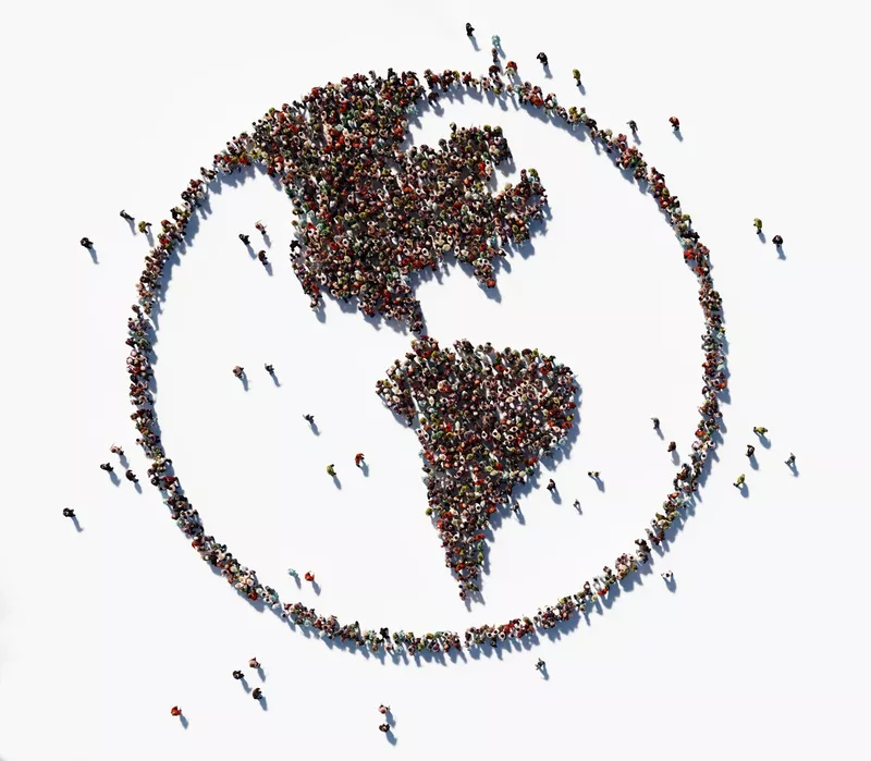
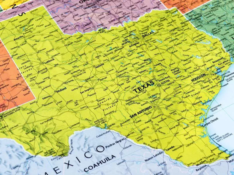
Although many areas of the world feel crowded, in some parts of the world, people are spread pretty far apart. There's actually plenty of space for everyone. Here's a fun piece of geography for kids: Technically, all the humans on Earth could fit into one U.S. state.
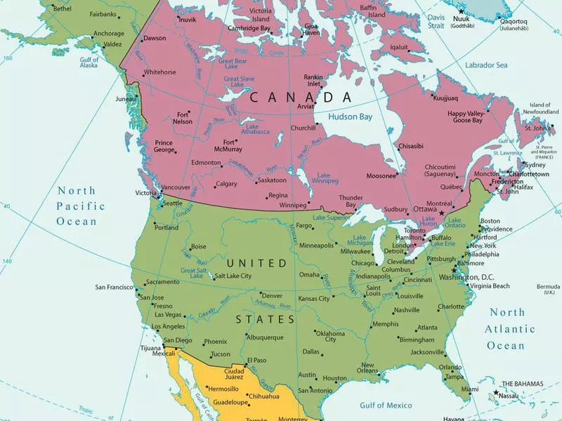
That state is Texas, which has a land area of 262,000 square miles. By converting square miles to square feet (here's a calculator to help), then dividing by the world's population (7.8 billion), there are more than 936 square feet per capita, or per person.
In other words, if all the people in the world moved to Texas, the second-largest state in the U.S., it would be about as crowded as New York City. Luckily, that will never happen, and in practice it's not possible at all. Just think of the traffic.
In reality, just over 29 million people live in Texas.
Deserts Aren’t Always Hot
/granite-web-prod/36/d1/36d1cacd0b3f4a688f9c5a4bdeacdb59.jpeg)
Deserts are a common geography feature, but they don't always look how the movies show them. When you picture a desert, you probably imagine someplace hot, sandy and dry, maybe with a tumbleweed or a cactus thrown in for fun. Interestingly, not all deserts are hot and sandy.
A desert is defined as a geographical area that gets less than 10 inches of rain each year. Some places get very little rain, but still get very cold. Cold deserts are typically found near mountains or on plateaus. They get hot in the summer, but they have frigid winters that can get as cold as 40 degrees Fahrenheit below zero.
The Longest River in the World Is Over 4,000 Miles Long
/granite-web-prod/6b/e9/6be98facd85844c5b51b781779e58b91.jpeg)
From coast to coast, the United States is around 2,500 miles wide. The longest river in the world is almost twice as long.
The Nile River is one of the world's most interesting geography features, and it stretches across Africa for 4,132 miles. The next longest river, the Amazon River in South America, is 4,000 miles long.
There are crazy long rivers in the U.S., too, like the Missouri River (2,341 miles) and the Mississippi River (2,318 miles). Don't be fooled by their names. Both the Missouri and Mississippi stretch far beyond the states they're named after. And no matter how big a river is, it always leads to the ocean.
The Deepest Part of the Ocean Is About Seven Miles Deep
/granite-web-prod/9e/69/9e69f32427514ee7ba580da3697fbc0d.jpeg)
No list of geography for kids facts would be complete without talking about oceans. Oceans are bigger and more mysterious than many of us realize. About 71 percent of the earth is covered in the waters of the ocean, and it's way deeper than even the deepest swimming pool in the world.
The average depth of the ocean is 2.3 miles, or 12,100 feet. But the ocean gets a lot deeper than that in some places. In the Pacific Ocean, explorers discovered the Mariana Trench. Within that dark crevasse is an extra deep spot named Challenger Deep. Scientists estimated the deepest point at about 36,200 feet deep.
The World’s Tallest Mountains Literally Reach the Sky
/granite-web-prod/5d/2d/5d2db05a0dff40f88b80a30aa84866a9.jpeg)
The tallest mountains in the world are really, really tall. Mount Everest is about five and half miles above sea level, or 29,032 feet tall. The next tallest mountain, K2, is 28,251 feet tall.
Those mountains and others reach the top of the troposphere, the layer of the atmosphere closest to the ground. On mountaintops that high, the air is very thin and has much less oxygen than at sea level.
Climbers who brave Mount Everest need to bring oxygen tanks to help them breathe. Even then, it's extremely dangerous. To this day, the tops of the world's tallest mountains are some of the riskiest geographical features to explore.
It Would Take You Over 20,000,000 Steps to Walk Around the World
/granite-web-prod/31/d6/31d6f94cd15f4b95b04122ef41474d73.jpeg)
It's one thing to fly around the world in a plane. Doing it on foot is quite another. The earth is a sphere, but it's not a perfect sphere. Because it's uneven, it's hard to measure exactly how many miles it is around the earth.
For an estimate, it's about 24,901 miles around the middle of Earth. Walking that distance would take about 20 million steps, and you'd have to figure out how to get across the oceans, too.
No one needs that much exercise, but a few people decided it was worth the effort. Maybe this list of geography for kids will inspire you to join them one day.